Profile
Alexander Treliving


-
About Me:
Originally from Durham, I currently live in Chester with my wife. Being a geographer is amazing – it’s led me to some really interesting places and I now use my geography knowledge and skills in my job.
In my spare time, I enjoy baking puddings, building Lego sets and practising card magic. I’m also a bit of a chocoholic 🍫 and long-time supporter of Newcastle United.
-
Read more
I really enjoy being in the outdoors – there’s nothing better than a woodland walk, listening to the birds and enjoying nature. I also try to get out and about on my bike and, when the weather isn’t so good, go to the pool for a swim.
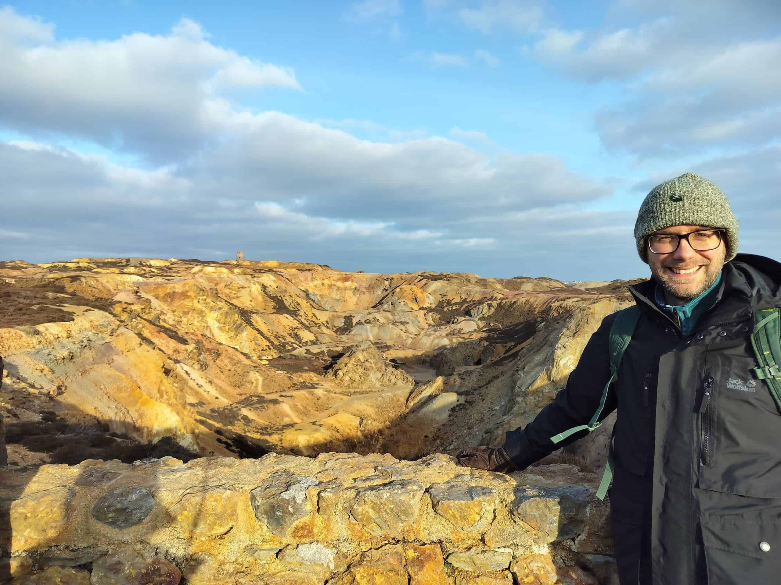
I love visiting and exploring new places at home and abroad. Recently, I had a career break and went backpacking around Europe with my wife for 3 months! We visited 9 countries including Poland, Slovenia and Switzerland.
As well as geography, I also love history and you can often find me exploring medieval castles and ancient Roman sites. I recently visited Pompeii in Italy, exploring the ruined city and climbing the infamous volcano, Mount Vesuvius! 🌋
Fun fact! – I was an extra in the first Harry Potter film.
-
My pronouns are:
he/him
-
How I use Geography in my work:
I use geography in several ways. 1. Mapping Locations – using maps and Geographic Information Systems (GIS) to show where every property and piece of land is. 2. Coordinates – every property needs an exact location and I use grid references and coordinates to give them a precise location on a map.
-
My Work:
I work with geographic data to make sure every place and property has an accurate name, address and location, so we can all find our way around – without address data, we’d be lost…literally!
-
Read more
As a Local Land & Property Gazetteer Officer, I manage geographic data to keep track of all the land and buildings in a local area. Think of it like making a huge, accurate map and list of every place you can think of. From houses, shops, schools and hospitals to lakes, woodlands, caves and parks. We even store info on things like statues, phone boxes and castles!
Think about the places you are familiar with – where you live, your school or the shops you visit – each one has an address that was created by someone like me.
In my job, I have to do the following:
- Collect information about properties and land, like addresses, locations and classifications – basically, where is it and what is it?!
- Make sure the details are correct so we all know where everything is.
- Tracking down missing information investigating by checking planning applications, maps, aerial photos and site visits. Like a geography detective!
- Update records when new buildings are built or old ones are knocked down.
- Store the records safely in a huge geographic database called a gazetteer.
My work is important because it helps things like:
- Emergency services find the right place quickly.
- Navigation on map apps.
- Post delivered to the right address.
- Councils to operate effectively and plan services, like waste collections.
In short, I make sure the official list of places in the area is always up to date and accurate!
-
My Typical Day:
My day always begins with a filling bowl of porridge . As I work from home most of the time, I don’t have a commute. I usually start work around 9am and finish around 5pm (with a break for lunch and lots of tea/biscuit breaks!).
-
Read more
Although I work from home most of the time, I do pop in to the office for team meetings every other month. My team also have a short Monday morning catch up meeting on Microsoft Teams and everyone can easily get in touch via email or chat.
My work is 90% computer/desk-based though I do venture out on site visits every now and again. This is especially useful if there’s a tricky property to locate on the map.
-
What I'd do with the prize money:
If I win the prize money, I will donate it all to the Geographical Association, whose mission is to ‘further geographical knowledge and understanding through education’.
-
Education:
Durham School (2002 – 2007), for GCSEs and A-levels
Lancaster University (2007 – 2011), for undergraduate and postgraduate degrees
-
Qualifications:
GCSEs: x10 including geography, history and ICT
A-levels: Ancient History, Geography, Media Studies
Undergraduate Degree: BSc Geography
Postgraduate Degree: MSc Geoinformatics (a combination of geography and ICT) – perfect for my current job!
-
Work History:
Warner Bros: Film Extra (Harry Potter and the Philosopher’s Stone)
Past Times: Sales Assistant
English Heritage: Britain from Above Project Cataloguer
-
Current Job:
Local Land & Property Gazetteer Officer
-
Employer:
Local Government
-
My Interview
-
How would you describe yourself in 3 words?
Location, Location, Location!
What did you want to be after you left school?
A weather presenter on the TV 🌦️
Were you ever in trouble at school?
Never, I was very quiet.
If you weren't doing this job, what would you choose instead?
A magician! 🪄
Who is your favourite singer or band?
Keane
What's your favourite food?
Jam roly-poly!
Tell us a joke.
I met the person who invented the part of a map that explains what each symbol means.--- What a legend!
-